
![]()
Strumenti di accessibilità
Service tools
Lingua
Watch Expo 2015 on Google Earth
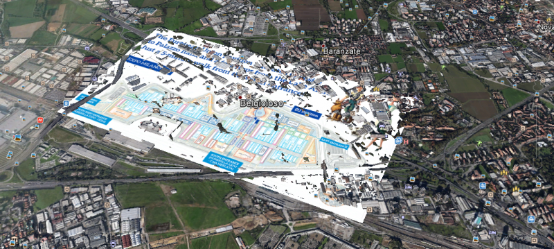
Our prominent colleague from the Joint Research Centre of the European Commission Frank Pabian, Senior Nuclear Nonproliferation Monitoring and Verification Analyst, has created a very cool Google Earth overlay with the map of Expo 2015 showing the position of the EU pavilion.
The map will show up automatically overlaid on the Google Earth image. By clicking on and off the checked box under “temporary places” it is possible to flick back and forth between the Expo map and the underlying real world overhead view.
Moreover if you look at Google Earth without doing any adjustments, all you will see is a view on Commercial satellite imagery dated October 16, 2011 (long before any construction on Expo had started). However, if you simply click on the little clock icon at the top left of the Google Earth screen, magically a view from satellite appears dated from April 10, 2014 showing the progress of the construction to that date (only 8 months ago).
If you would like to save the map for future viewing, you just need to click on the hyperlink above ...then "SAVE"...then "Save to my places". At which point the file will move from “temporary places” to the personal file.